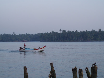
 The Beypoor River, close to the point where Thomas Baber set off from on his journey to the Nilgiris Hills.
When I visited Beypore in December 2006, I knew that is was highly likely that I was following in Thomas Baber's footsteps, however at that time I had no proof that he had ever actually been to the town.
Recently however I have discovered the following account that he wrote in 1830, and which was subsequently published in the Asiatic Journal[1] describing a journey that he had made in 1823, from Calicut to the Nilgiris Hills.
The account makes it clear that he had been present in the area inland of Kozhikode as early as 1802, however at that time it is unlikely that he reached as far inland has the tops of Ghats themselves.
Thomas Baber was a contemporary of John Sullivan, the Collector of Coimbatore who is credited with founding Ootacamund. Sullivan first explored the region in January 1819, reaching the hills from Salem coming up from the eastern side of the hills.
The route in from the east, whilst considerably longer, is much less steep than the shorter route from the western seaboard up over the ghats. The route from Beypore to Ootacamund is about 110 miles long, and climbs up over the 6,000 feet high ghats.
In 1822 Sullivan returned to the hills to build his house, the first European house on the site. During the following year 1823, Sullivan brought his wife to the newly built stone house.
When he arrived at "Ottakamund" on the 13th of June 1823, Thomas Baber must have been one of the very first visitors to Sullivan's new house.
They were both to suffer for their shared interest in improving the conditions of the local Indian's. Like Sullivan in the Nilgiris, Thomas Baber was also experimenting a few miles to the north in the Wayanad with new crops and with ways of encouraging improved forms of agriculture amongst the local tribesmen in the hills.
This journal is interesting both as a record of the changing situations in the rural parts of Malabar following the areas occupation of the region by the East India Company. Thomas, who was often highly critical of the East India Company officials and their public administration of the area, was able to compare the situation in the villages over time, and was in a position to contrast the villages shortly after 1800 with the conditions in the 1820's.
It has proved possible to match the account with maps of the area made in the 1950's and with Google Earth images. I hope one day to return to the area and to repeat the journey.
The account is too long for a single post, so I will break it up into sections to post over the coming weeks.
Thomas wrote the account, which appeared in the Asiatic Journal, whilst living in retirement in Hanwell, a small village to the west of London. Perhaps in that first cold November after thirty four years in India, he was already beginning to miss the area. After two years in a much changed Britain, and missing his family in India, he returned to live out the remainder of his life in India in 1833.
Thomas was to return to Ootacamund on a number of occasions during the final part of his life. On one of these visits in 1841, his son Henry Fearon Baber married the Honourable Maria Jane Harris grand daughter of Lord Harris of Seringapatam on the 26th of September 1841 at Ootacamund.
GEOGRAPHY OF MALABAR.
To the Editor.
SIR: As every thing relating to the salubrious climate of the Neelghurries,
Anglice “Blue Mountains,” on the coast of Malabar, must be interesting to all sojourners in India, I venture to submit the accompanying revised journal of a route from Calicut, via the river of Beypoor and passes of Carcote and Neddibett, in the year 1823.
With reference to the account given therein of the gold mines, and the mode in which that valuable metal is obtained, it appears to be deserving of the consideration of scientific persons, how far it would be desirable speculation to apply to the East-India Company for their permission to send out qualified persons to make the attempt to ascertain, by a local investigation and examination, the probable extent of the riches contained in the bowels of the earth in that portion of our Indian empire.
I am, Sir, &c.
Hanwell,15th Nov. 1830. T.H. Baber.
JOURNAL OF A ROUTE TO THE NEELGHURRIES FROM CALICUT.
By T.H. Baber, Esq.
LEFT Calicut at 5 P.M., 5th June 1823, and reached the ferry called
Mammaly Kadawer, on the Beypoor river, at sun-set, (distance six miles); embarked in one boat, my servants following in another: after rowing all night, reached
Ariacotta [2], (a bazaar on the banks of the Beypoor river,) about 7 A.M. – Average distance from Calicut to Ariacotta eight Malabar coss, or thirty-two English miles. I found Ariacotta Angâdy very much fallen off since I last visited it (1803); then there were between two and three hundred houses; at present the number is hardly one hundred. Owing, as the three head men stated, to the timber[3] , tobacco, and salt monopolies, particularly the first, which gave employment to a large proportion of the population of both this and the neighbouring Angâdies and Deshoms, on the banks of the Beypoor river.
Left Ariacotta[2] on the 7th at 8 A.M. The first two miles is by the high road from Ariacotta to Manjerry, after which a path to the left leads through a jungle for about half-a-mile to an open country for about two miles, terminated by a paddy field, intersected by a nulla, dry in the fair, but with about four feet water in the rainy season. About a hundred yards to the right is the illum (house) of the Pooliora Namboory, a land proprietor of considerable influence. After crossing this nulla, the road leads through a jungle for about a mile-and-half: about midway there is a nulla fordable during the fair season, but containing from five to six feet water during the monsoon. Here the road takes a circuitous direction to the right, open ground the whole way (about four miles) to the paddy fields in the vicinity of the Yadamunna Angâdy , in the centre of which is a nulla very difficult for a horse or palanquin to pass in the rainy season; for foot passengers there is a log of wood over a narrow part of the nulla.
Arrived at
Yadamunna[4] about 1 P.M. This bazaar is also on the banks of the Beypoor river, and is in a very deplorable state, partly owing to the same causes as Ariacotta, and partly to the turbulent dispositions of its inhabitants. All the worst characters have, however, been removed by death or banishment, and there is little danger to be apprehended of any further attempts to disturb the peace of the country. There are about eighty houses, most of them in very bad condition.
 Map showing the first stage of Thomas Babers route to Ootacamund. The actual route is coloured brown. Please click on the map for a larger version.
Started at 3 P.M. for, and arrived at,
Mombât Angady,[5] at 5 P.M. The first part of the road leads through jungle along the banks of the Beypoor river; about a quarter of a mile from Yadamunna is a nulla at all times fordable, and another about two miles and a half further on, only passable in boats in the rainy season. Here the country becomes more open, and continues so the whole way to the nulla at the foot of the
Mombât Angady, which is always fordable excepting for a few days during the height of the monsoon. Mombat is a Mopilla town, also on the banks of the Beypoor river; it contains about eighty houses, or about half the former number; until within the last twenty years a considerable trade used to be carried on here with the Balagat inhabitants, alias highlanders, viz, Nambolacotta, Parakameetil in Wynaas, Poonat or Mysore, Davaraiputton, and the Neelghurries, but has ceased since the plunder and massacre of a Baddagur, native of the Neelghurries, at Mombat, by a Mopilla maraunder named Cunhy Olan Cooty, who was executed in 1802. The people expressed a strong desire for the revival of this trade, which they said would be much facilitated by the establishment of an Oopakood, or salt gola, and of a shandy, or weekly fair, at
Mombat, and probably nothing would contribute so much to humanize the Mopilla population, or tend more to the prosperity of this and the rest of the towns bordering on the Beypoor river, as the renewal of this trade.
Left
Mombât on the 8th at 8, and arrived at Nellumboor at 10 A.M. The first two miles of the road is a mere jungle path, where it joins the high road from Manjerry by Wandoor, to Nellumboor. About a mile further on is the river Trikâkoon[6], fordable only during the fair season. It takes its rise at the Munjerri Mala, one of the Gâat mountains, and joins the Beypoor river about a mile east of Mombât, at a place called Moothraketty; I crossed it by means of a bamboo raft. From this river to Nellumboor, the distance is two miles and a half. Here I was met by the Kâristary, or Minister of Tachârâ Kawil Teeroopad, the Nellumboor Nadwâri, who had had the politeness to have the road opened the whole way from the Trikâkoon river to his easternmost farm called
Eddakarra, a distance of about ten miles. Within one hundred yards of Nellumboor I was met by the Teeroopad himself, who conducted me to a house he had prepared for my reception.
Nellumboor is the ancient residence of this Nadwari. The kowlgum[7] or palace is on the bank of the Beypoor river, surrounded with a high mud wall. There are from twenty to thirty Nair houses, occupied exclusively by his dependants, and a pagoda dedicated to Watakara the Paradevar (household god) of the Teeroopad family. The Teeroopad and his Kuriastan were very earnest in their wishes for the re-establishment of the commercial intercourse between the lower and upper countries by the Caracote pass, and seemed to think that the facilities for trade were much greater by this than any of the other passes leading through Wynaad.
[1]Pages 310-311, Journal of a Route to the Neelghurries from Calicut, Asiatic Journal (New Series) III.
[2] Ariacotta = Arikkod
[3] The timber monopoly has been abolished since this was written. Thomas was a strong critic of this monoploy, campaigning over many years for its removal.
[4] Yadamunna = Vadapuram.
[5] In November 1827, when I again visited the Neelghurries, I came by water as far as Mombat. [now Mambad]
[6] Trikakoon= Vada Auram Puzha
[7] An upper room has been lately built by the Teeroopad over the outer gate-way or entrance, purposely for the accommodation of travellers.


